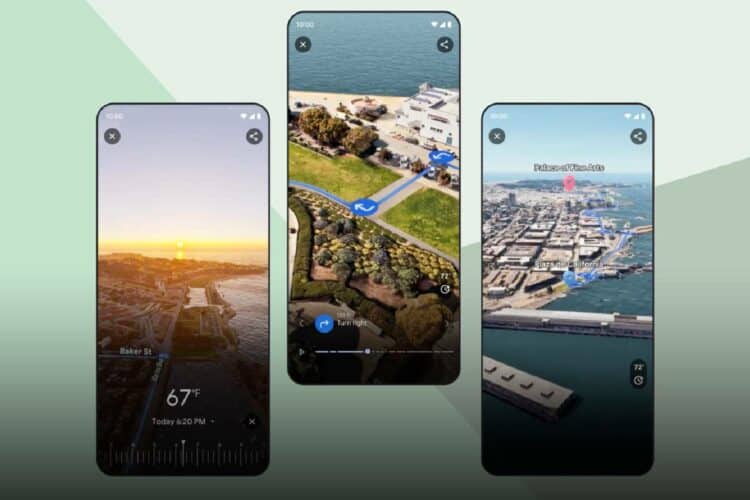
Google Maps has elevated journey planning with the introduction of Immersive View for routes.
Google Maps launches ‘Immersive View’: Here’s how it works
Google’s latest feature, Immersive View, is transforming how users visualise their travel routes, whether they are walking, biking, or cycling.
Currently rolling out in 15 cities, Immersive View integrates weather, traffic, and multidimensional views to provide a comprehensive snapshot of one’s journey.
The creation of this feature began with the collection of billions of high-resolution images sourced from various methods, including planes and Street View cars.
These images undergo a complex stitching process, aligned meticulously with Google Maps data using advanced photogrammetry techniques, ensuring accuracy within centimetres.
Machine learning plays a crucial role in the feature’s functionality, where AI and computer vision work in tandem to identify and label elements within the photos, such as sidewalks and street signs.
These models, trained on an extensive range of global images, adapt to regional differences. For instance, they distinguish between traffic signs in different countries.
The transition from 2D to 3D is a pivotal step in Immersive View’s development. Aerial camera systems, akin to those used in Hollywood, capture imagery to build the 3D map.
The terrain of roads and the architecture of buildings are modelled to provide a realistic representation of the world.
Differentiating between Immersive View for routes and places, Google has focused on creating a seamless and realistic route navigation experience.
Techniques such as occlusion and B-spline curves are employed to ensure the route line is both accurate and aesthetically pleasing, providing users with a smooth and clear overview of their path.
Google Maps’ trusted real-world information, such as weather and traffic conditions, is then overlaid onto the 3D model.
Is Google Maps’ new feature available in South Africa?
This feature allows users to visualize live traffic patterns, informed by historical data analysis, to predict and display likely conditions at different times and days.
Immersive View for routes is starting to roll out in:
- Amsterdam;
- Barcelona;
- Dublin;
- Florence;
- Las Vegas;
- London;
- Los Angeles;
- Miami;
- New York;
- Paris;
- San Francisco;
- San Jose;
- Seattle;
- Tokyo; and
- Venice.


