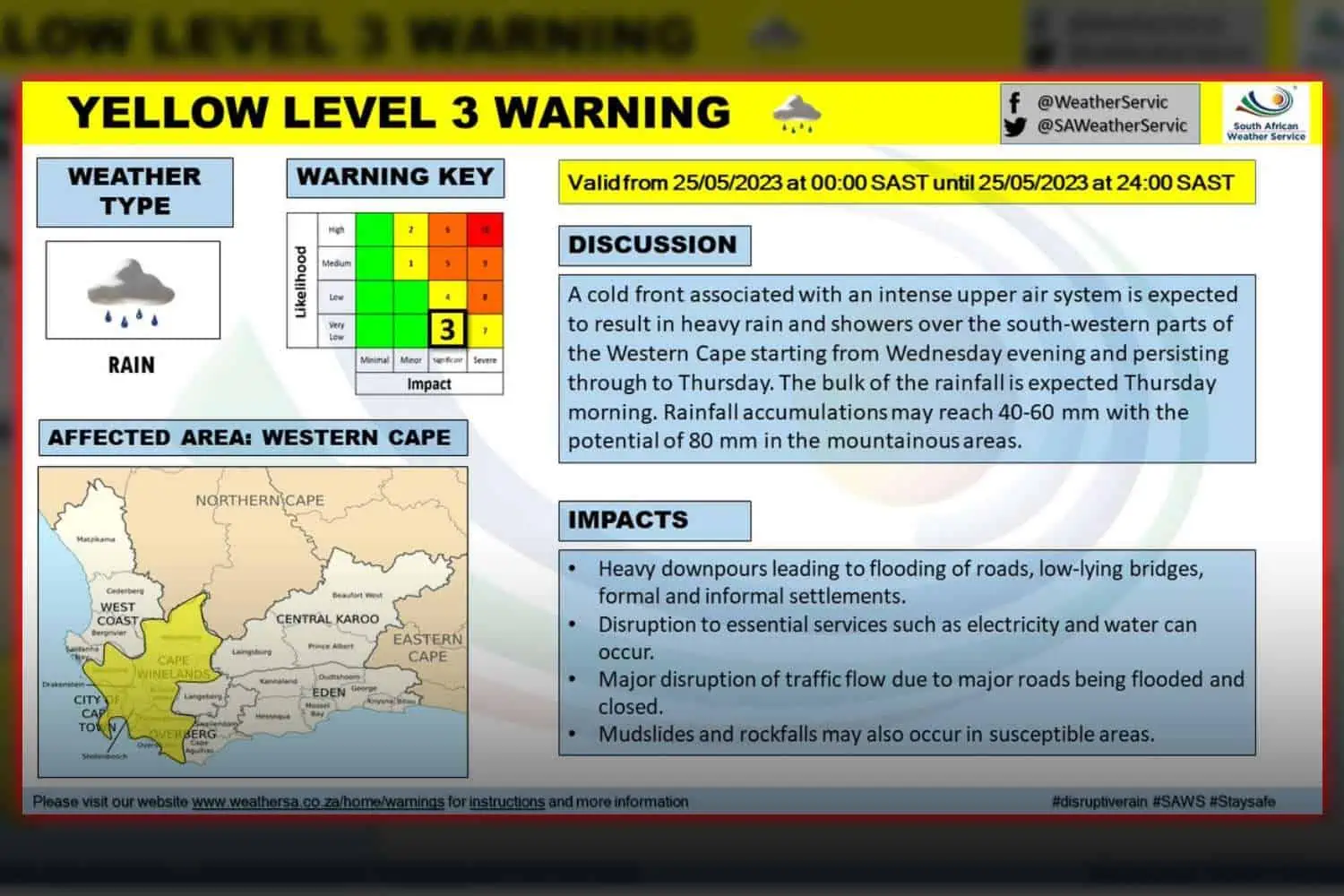
The South African Weather Service (SAWS) has issued a yellow level 3 warning for disruptive rain in Cape Town and South Western parts of the Western Cape starting tonight.
Cape Town weather: Expect ‘disruptive’ rain on
In a statement, SAWS warned of an approaching cold front accompanied by an intense upper air system that is expected to bring heavy rain and showers to the region, with the majority of rainfall anticipated on Thursday morning.
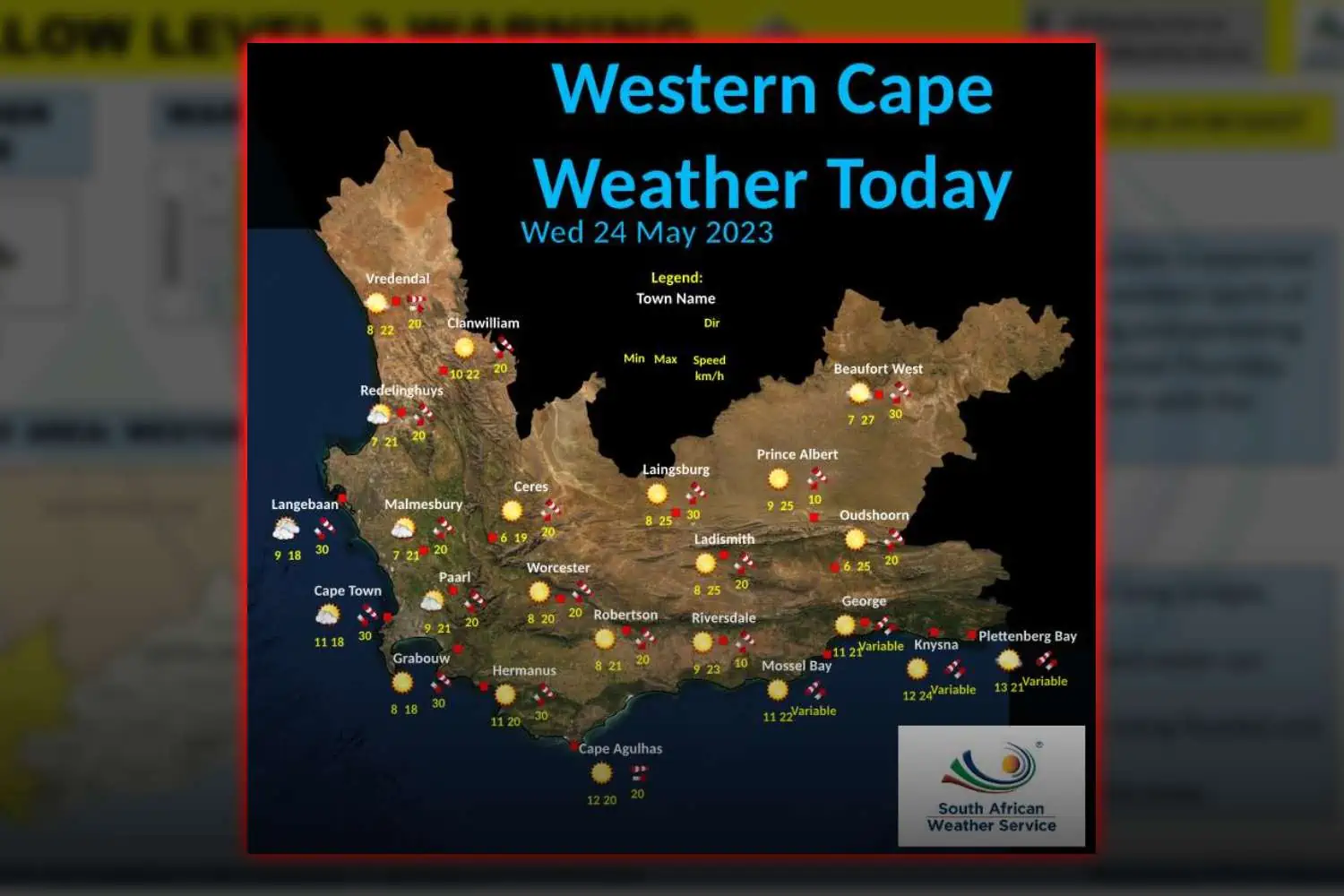
On Wednesday, fog patches will likely hover along the West and South coast, bringing along partly cloudy conditions and moderate temperatures.
The same can’t be said about the South Western parts of the Western Cape, however, where cold and cloudy conditions will be exacerbated by scattered showers.
The Karoo should see warm conditions, while along the coast, light-to-moderate north-westerly winds may pick up speed throughout the day.
The cold front, supported by an intense upper air system, is predicted to make landfall in the Western Cape on Thursday.
Daytime temperatures are anticipated to significantly drop on Thursday and Friday across the Western Cape and extend into the Eastern Cape.
In some areas, maximum temperatures may fall below 10°C, particularly over the Southern high-lying areas of the Namakwa region in the Northern Cape and the interior of the Western Cape.