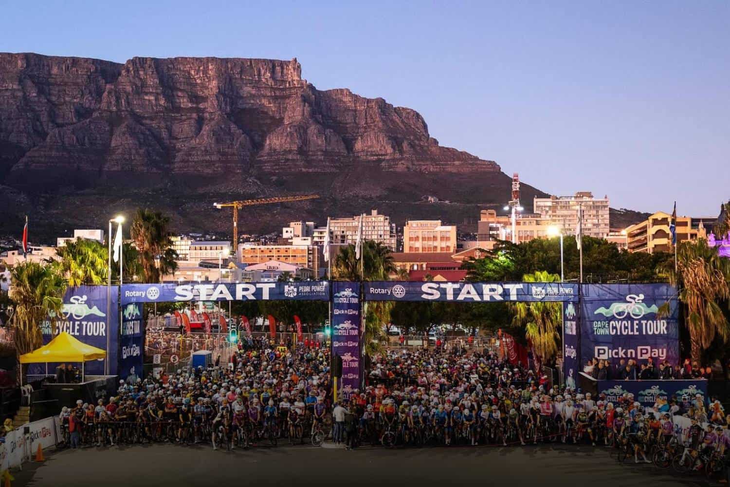
The 2024 Cape Town Cycle Tour is set to reshape traffic patterns in the city this weekend.
2024 Cape Town Cycle Tour road closures this weekend
Residents and visitors of Cape Town should prepare for an array of road closures this upcoming weekend due to the Cape Town Cycle Tour.
The event’s popularity necessitates extensive preparations to accommodate the safety of participants and spectators, leading to a comprehensive timetable of road closures across the city.
Saturday, 9 March 2024
| Area | Details | Times |
|---|---|---|
| CBD | Castle Street between Strand Street & Darling Street | Saturday, 14h00 – Sunday, 16h00 |
| Darling Street between Lower Plein & Buitenkant Street | Saturday, 15h00 – Sunday, 12h00 | |
| Corporation Street between Darling Street & Caledon Street | Saturday, 15h00 – Sunday, 12h00 | |
| Parade Street between Darling Street & Caledon Street | Saturday, 15h00 – Sunday, 12h00 | |
| Strand Street & Newmarket Street between Lower Plein Street & Russel Road | Saturday, 21h00 – Sunday, 16h00 | |
| Nelson Mandela Boulevard incoming Strand Street off-ramp | Saturday, 19h00 – Sunday, 16h00 | |
| Green Point | Helen Suzman Boulevard from Beach Road to Traffic Circle (City-bound carriageway) | Saturday, 14h00 – Sunday, 21h00 |
| Noordhoek | Chapman’s Peak Drive (M6) and Noordhoek Road (M6) to Princess Street | Saturday, 18h00 – Sunday, 18h00 |
Sunday, 10 March 2024
| Area | Details | Times |
|---|---|---|
| Strand Street & Newmarket Street between Adderley Street & Russel Road | 04h00 – 16h00 | |
| Buitenkant Street between Darling Street & Caledon Street | 04h00 – 12h00 | |
| Sir Lowry Road between Canterbury Str & Christiaan Barnard Boulevard | 04h00 – 09h00 | |
| Hanover Street between Darling & Tennant Street | 04h00 – 09h00 | |
| Adderley Street (from Strand – Riebeek) | 07h00 – 16h00 | |
| Riebeek Street (Westbound – between Adderley & Long Street) | 07h00 – 16h00 | |
| Riebeek Street (Full Closure – between Long & Loop streets) | 07h00 – 16h00 | |
| Cape Town CBD | Riebeek Street (Eastbound – between Bree & Buitengracht Street) | 07h00 – 16h00 |
| Long Street – (closed at Riebeek Street) | 07h00 – 16h00 | |
| Loop Street – (closed at Riebeek Street) | 07h00 – 16h00 | |
| Somerset Road – (one lane closure between Buitengracht & Ebenezer Street) | 10h00 – 15h00 | |
| Darling Street between Adderley Street & Lower Plein Street | 04h00 – 12h00 | |
| Lower Plein Street between Strand Street and Darling Street | 04h00 – 12h00 |
| Location | Details | Time |
|---|---|---|
| Woodstock | Phillip Kgosana Drive (M3) Outbound between Roodebloem Road and Hospital Bend. Traffic will be diverted to Main Road | 05h30 – 12h30 |
| CBD, Woodstock | Nelson Mandela Boulevard (N2) Eastbound | 05h30 – 12h30 |
| Hospital Bend (N2, M3) Interchange | Settlers Way (N2) to Muizenberg (M3) ramp (Southbound) M3 on-ramp from Groote Schuur Hospital (Anzio Road – Southbound) | 05h30 – 12h30 |
| Mowbray, Rondebosch, Newlands, Claremont, Bishopscourt | M3 (Rhodes Drive, Union Avenue, Paradise Road, Edinburgh Drive) Southbound Including all on-ramps between Nelson Mandela Boulevard up to Trovato Link | 06h00 – 13h30 |
| Wynberg, Constantia, Tokai | M3 Freeway (Blue Route) Southbound, including all on-ramps between Trovato Link and Steenberg Road | 06h00 – 13h30 |
| Tokai | Steenberg Road (M42) M3 off-ramp to Main Road | 06h15 – 12h30 |
| Tokai, Lakeside | Main Road (M4) – Between Steenberg Road & Clairvaux Road | 06h15 – 12h30 |
| Route Section | Hours |
|---|---|
| Main Road (M4) – Clairvaux Road to Fish Hoek Traffic Circle | 05h45 – 12h50 |
| Main Road (M4) – Fish Hoek Traffic Circle to Glen Road, Glencairn | 05h45 – 12h30 |
| Main Road (M4) – Glen Road to Simon’s Town | 05h50 – 12h30 |
| Main Road (M4) – Simon’s Town to entrance of Cape Point Nature Reserve | 06h00 – 14h00 |
| Main Road (M4) – Entrance of Cape Point Nature Reserve (M4) to Perdekloof (M65) | 06h15 – 14h00 |
| Main Road (M4) – Perdekloof to Soetwater | 06h30 – 14h00 |
| Slangkop Road (M82) Soetwater to Kommetjie Road (M65) | 06h45 – 14h00 |
| Short Route (42km) Incoming – M3 to CBD | Details | Time |
|---|---|---|
| Wynberg, Constantia, Tokai | M3 Freeway inbound (Blue Route) Southbound & Northbound, including on-ramps between Steenberg Road and Trovato Link | 10h00 – 15h00 |
| Mowbray, Rondebosch, Newlands, Claremont, Bishopscourt | M3 inbound (Rhodes Drive, Union Ave, Paradise Road, Edinburgh Drive) Including all on-ramps between Trovato Link up to Nelson Mandela Boulevard | 10h00 – 15h00 |
| Hospital Bend (N2, M3) Interchange | M3 inbound to Settlers Way (N2) Groote Schuur Hospital onramp from M3 (Anzio Road – Northbound) | 10h00 – 15h00 |
| Nelson Mandela Boulevard (after top of Hospital Bend) | Nelson Mandela Boulevard inbound Including on ramps and off ramps between top of hospital bend to CBD | 10h00 – 15h00 |
| Location | Route | Times |
|---|---|---|
| Kommetjie, Ocean View, Masipumelele | Kommetjie Road (M65) Slangkop Road to Ou Kaapse Weg Extension | 06h45 – 14h00 |
| Noordhoek, Sun Valley | Ou Kaapse Weg Extension (M64) Kommetjie Road (M65) to Noordhoek Main Road | 06h45 – 15h00 |
| Noordhoek, Sun Valley | Noordhoek Main Road (M6) Ou Kaapse Weg Extension (M64) to base of Chapman’s Peak Drive | 06h45 – 15h00 |
| Hout Bay, Llandudno, Camps Bay, Bakoven | Victoria Road (M6) – Northbound and Southbound Princess Street, Hout Bay, to Camps Bay | 07h00 – 17h30 |
| Camps Bay, Bantry Bay and Clifton | Victoria Road (M6) – Northbound and Southbound Between Houghton Road and Camps Bay Drive Victoria Road (M6) Northbound and Southbound Between Camps Bay Drive and The Meadway | 07h00 – 17h30, 04h00 – 17h45 |
| Camps Bay, Clifton, Bantry Bay | Victoria Road (M6) – North and Southbound The Meadway to Lower Kloof Road | 07h30 – 18h00 |
| Camps Bay, Clifton, Bantry Bay | Victoria Road (M6) – Northbound and Southbound Lower Kloof Road to Queens Road, Sea Point | 07h30 – 17h45 |
| Bantry Bay, Sea Point | Queens Road (M6) Victoria Road to Beach Road | 05h00 – 17h45 |
| Location/Area | Details | Time |
|---|---|---|
| Sea Point, Green Point & Mouille Point | Beach Road (M6) – City bound carriageway Queens Road Circle to St Johns Road | 05h00 – 18h30 |
| Beach Road (M6) – City bound carriageway St Johns Road to Helen Suzman Boulevard (M6) | 05h00 – 18h30 | |
| Beach Road and Beach Road towards Fritz Sonnenberg Road | 05h00 – 18h30 | |
| Green Point | Fritz Sonnenberg Road between Beach Road and Granger Bay Boulevard, Green Point Circle. (Controlled Access point) | 07h30 – 19h30 |
| Green Point | Bill Peters Drive at Bay Road LOCAL ACCESS ONLY | Saturday, 14h00 – Sunday, 21h00 |
| Green Point | Helen Suzman Boulevard (M6) Eastbound from Beach Road to Green Point Traffic Circle | Saturday, 14h00 – Sunday, 21h00 |
What is the historical significance of the Cape Town Cycle Tour?
The inception of the Cape Town Cycle Tour traces back to a vision by Bill Mylrea, John Stegmann, and Louis de Waal, initially proposed as a protest ride.
The aim was to advocate for the inclusion of bicycle infrastructure in urban planning and to promote cyclist safety on Cape Town’s roads as of 1978.
Despite not achieving its immediate objectives, this event has evolved dramatically, transforming into the world’s largest timed cycling event.
This ironic twist of fate has not only elevated the tour to a global stature but also realised its foundational goals indirectly.
The proliferation of cycling in South Africa, significantly attributed to the Cape Town Cycle Tour, has spurred the implementation of bike lanes and cycle safety projects throughout Cape Town and its surroundings.