After a dry and somewhat pleasant weekend, wet conditions accompanied by harsh winds are expected to return to Cape Town on Monday.
Wave spills expected in Cape Town shoreline
According to the South African Weather Service (SAWS), Capetonians ought to expect a strong cold front which will bring along with it strong winds that “may result in property damage in some areas.”
“This cold front will cause gale force winds between Cape Columbine and Cape Agulhas and significant wave heights, from a south-westerly direction, picking up to between 4.5 and 6.5 m between Hondeklip Bay and Cape Agulhas during the morning hours, which is expected to spread along the south coast to Plettenberg Bay in the afternoon.,” the weather authority warned.
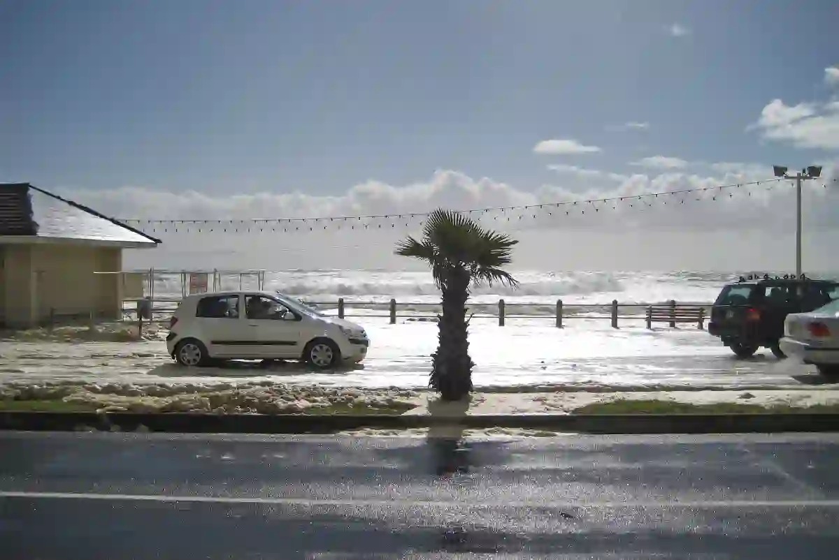
Moreover, SAWS expects these torrent conditions to carry over into Tuesday. The province’s coastlines will likely see large waves spill over the shoreline during high tide which usually falls between 05:00-06:00 and 17:00-18:00.
“This may result in localised infrastructure damage along the Western Cape coastline, as well as difficulty in navigation at sea for small vessels, with the likelihood of vessels taking on water and possibly capsizing,” SAWS added.
Possible snowfall in western parts of the province
Rescue teams in the western parts of the Western Cape will be briefed on the potential flooding that may occur as a result of rainfall levels ranging between 30-40mm expected in the region.
The western mountains of the Western Cape as well as the southern high grounds of the Northern Cape will see temperatures drop below 10°C, bringing along the “possibility of snowfalls which may be as deep as 5 to 15cm.”
Cape Town weather warnings for Monday 12 July 2021
According to SAWS, while the strong winds are expected to slow down from Tuesday, sustained frosty temperatures and sporadic spirts of rainfall are likely to remain for the better part of the week in the interior of the Western Cape and some parts of Eastern and Northern Cape.
These are your weather warnings, issued by the SA weather service:
- Yellow Level 4 Warning for rain leading to flooding (formal/informal settlements) is expected over the City of Cape Town, Witzenberg, Drakenstein, Stellenbosch and Theewaterskloof municipalities (W-Cape) on Monday (12/07/2021).
- Yellow Level 4 Warning for snow leading to possible loss of livestock/crops is expected for southern Namakwa (N-Cape), Cederberg, Witzenberg, Breede Valley municipalities (W-Cape) from Monday afternoon into early Tuesday morning, spreading to the eastern Garden Route Monday night into Tuesday afternoon (12-13/07/2021).
- Yellow Level 2 Warning for wind resulting in possible localised infrastructure damage over the southern Namakwa (N-Cape), Central Karoo (W-Cape) on Monday including the coastal areas between Cape Columbine and Cape Agulhas Monday morning, spreading to Plettenberg Bay in the afternoon, subsiding on Tuesday (12-13/07/2021).
- Yellow Level 2 Warning for waves resulting in difficulty in navigation at sea between Hondeklip Bay and Cape Agulhas on Monday morning spreading to Plettenberg Bay by evening, subsiding by Tuesday afternoon (12-13/07/2021).